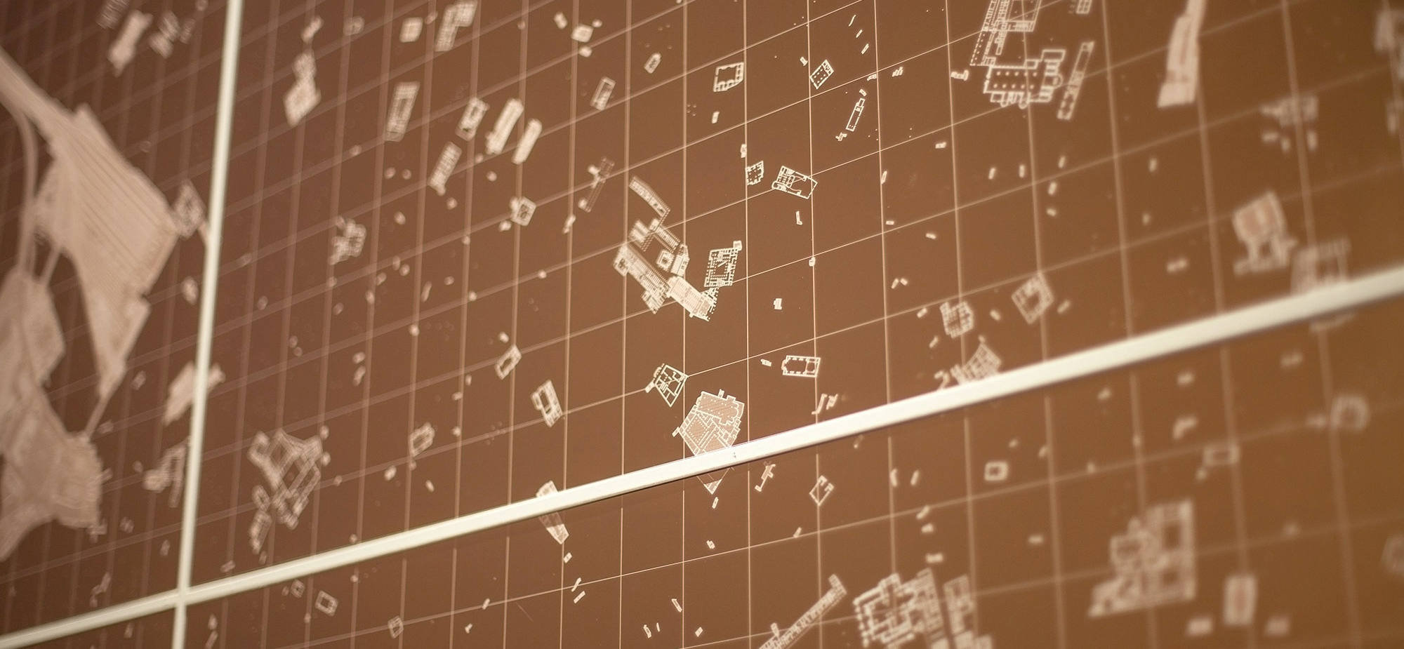
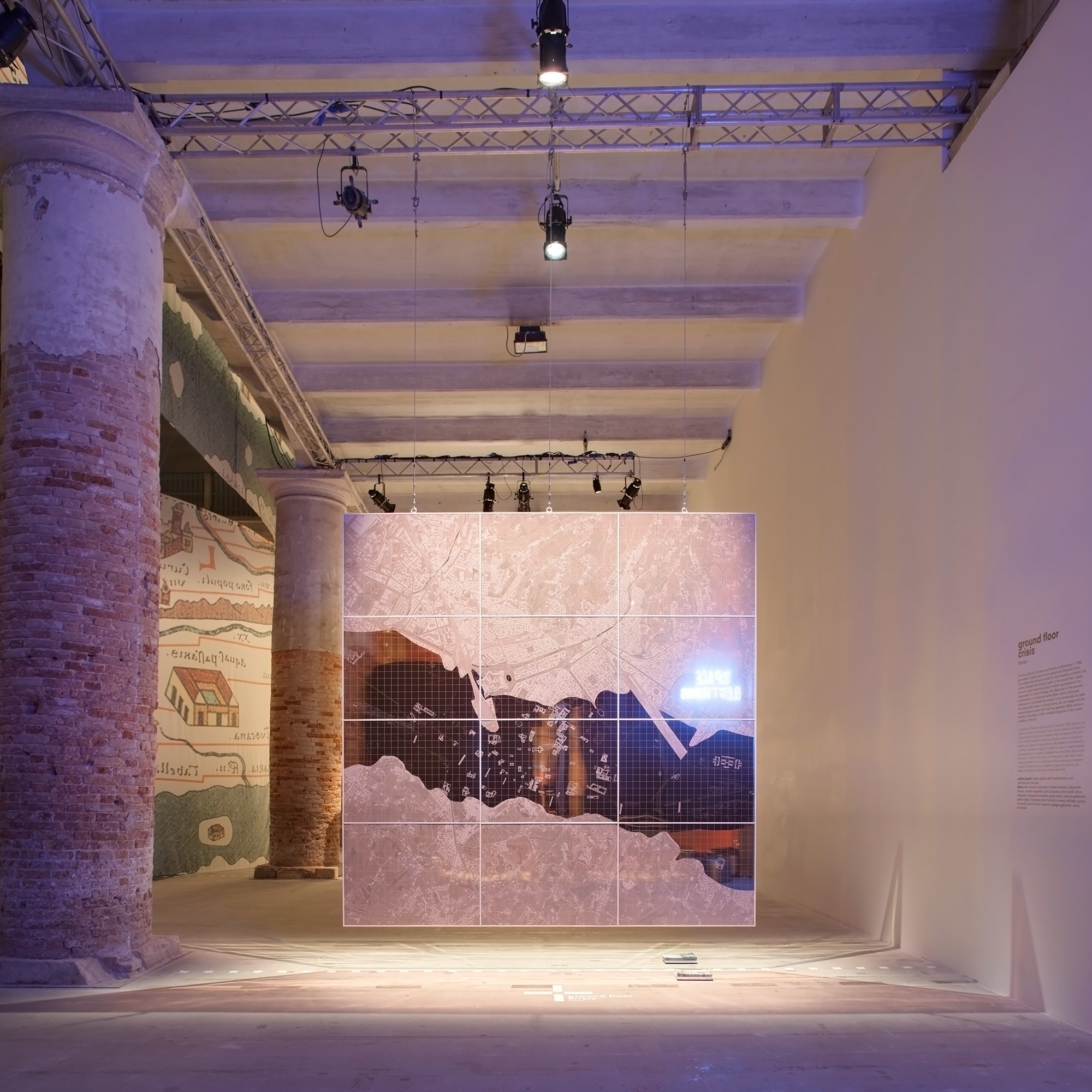
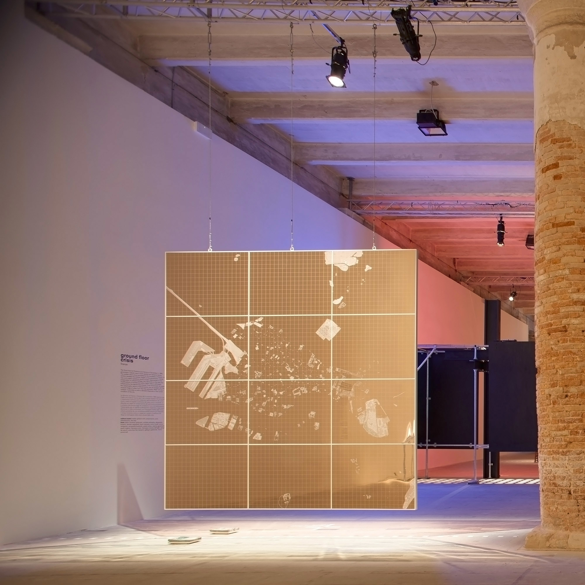
The flood that hit Florence and Venice on November 4, 1966, generated a tabula rasa in both spatial and temporal terms. The sudden short circuit provoked by the inundation of historic centers revealed the intrinsic fragility of the ground floor, raising new and urgent questions about modern approaches to the preservation of cultural heritage. Coincidentally, 1966 was also the year in which both l’Architettura della città and Complexity and Contradiction in Architecture were published. The renewed interest in the form of the city reflected in these texts marked a radical shift—at least from a theoretical standpoint—in the linear and once apparently inexorable trajectory of modern architecture. If we momentarily set aside the catastrophic nature of alluvial events, we can engage with the unusual image of urban form that they generate. The ever-more-frequently amphibious condition of Italian cities erases filters and spatial sequences, and redefines the articulation of the boundaries between interiors and exteriors, between the public and private realms. Water acts as a catalyst: it provides us with a detailed diagnosis of the current condition of the city. While post-flood accounts and inventories of damage yield an accurate image of the ground floor’s usage, the section plane of the water level redraws its architectural substance. Encountering both monuments and minor buildings, and both public spaces and more intimate ones, it abolishes hierarchies, elucidates formal richness, and reveals a palimpsest that must be completely rewritten.
L’alluvione che ha colpito Firenze e Venezia il 4 Novembre 1966, ha generato una tabula rasa sia in termini spaziali che temporali. L’improvviso corto circuito provocato dall’inondazione dei centri storici ha messo a nudo l’intrinseca fragilità dei piani terra delle nostre città, sollevando i primi dubbi sull’approccio moderno alla conservazione del patrimonio storico. Il 1966 coincide anche con l’anno in cui vengono pubblicati l’Architettura della città di Aldo Rossi e Complexity and Contradiction in Architecture di Robert Venturi. Il rinnovato interesse per la forma della città storica che emerge da questi testi, segna un cambiamento radicale, almeno dal punto di vista teorico, nello sviluppo apparentemente inesorabile del movimento moderno in architettura. Se per un momento provassimo ad andare oltre l’aspetto catastrofico di questi eventi, ci troveremmo di fronte a un’immagine della forma urbana del tutto inusuale. La sempre più frequente condizione anfibia dei centri storici italiani scandisce e ridefinisce il margine che divide spazio esterno e interno, spazio pubblico e spazio privato. L’acqua agisce come catalizzatore: ci fornisce una diagnosi dettagliata della condizione attuale della città. Se la conta dei danni e i rilievi eseguiti subito dopo l’alluvione ci forniscono una testimonianza accurata sulla condizione e sull’uso dei piani terra, la sezione orizzontale generata dal livello dell’acqua ridisegna idealmente la forma architettonica della pianta della città. Sezionando idealmente monumenti ed edifici minori, spazi pubblici e spazi dell’intimità, l’acqua della piena abolisce momentaneamente ogni gerarchia, mette in luce inaspettate ricchezze formali e rivela palinsesti che andrebbero completamente riscritti.
This is a unique website which will require a more modern browser to work!